
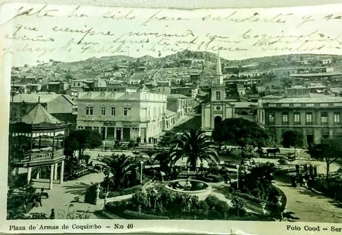
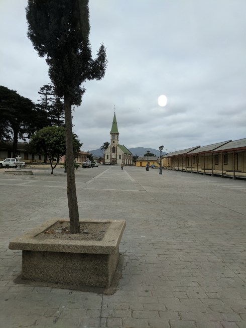
Plaza de Armas, Coquimbo, Chile 1920’s
The morning skies were overcast, but for a day long tour, it was likely better than frying under a burning sun. Our tour guide arrived at 8:00 and we were off. He had just one other passenger on the tour that day, a young woman student from Germany, Zora, who was working at one of the other hostels and had the morning off. We had already met another young woman from Europe who was on a year long tour of South America. She had run out of money and was working at the Terazza Restaurant.

Jubo and Murchie were so excited..they were telling their new friends all about the tour..
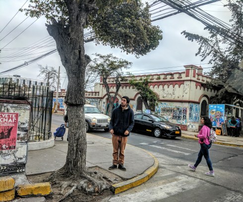
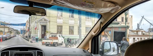
We wound our way through the narrow streets of La Serena on the way out of town. Because the sreets are so narrow, in a effort to deal with vehicle traffic, many have become one way.
The area where La Serena is located was once inhabited by the pre-Hispanic village called Viluma or Vilumanque (Mapudungin)….. Snakes and Condors.
The origin of the Diaguita culture is traced back to an archaeological culture known as El Molle Compolex which existed from 300 to 700 CE. Later this culture was replaced in Chile by las Animas Complex that developed between 800 and 1000 CE. It is from this last culture that the Archaeological Diaguita culture emerged around 1000 CE. The classical Diaguita period was characterized by advanced irrigation systems and by Pottery painted in black, white and red.

Replica of a Diaguita ceramic bowl from northern Chile.
“It is generally accepted that Diaguita incorporation into the Inca Empire was through
warfare which caused a severe depopulation in the Transverse Valleys of Norte
Chico. According to scholar Ana María Lorandi the Diaguitas, and specially the Calchaqui
Diagui9tas, would not have been conquered easily by the Inca Empire. Once conquered
the eastern Diaguitas did not unanimously accepted Inca rule. The Incas appointed
Kurakas and established mitmas in the Chilean Diaguita lands.] The Incas did also
influence the Diaguitas who adopted pottery designs from Cuzco and Inca techniques in
agriculture and metalworking.” From Wikipedia

Map of the city in 1717.
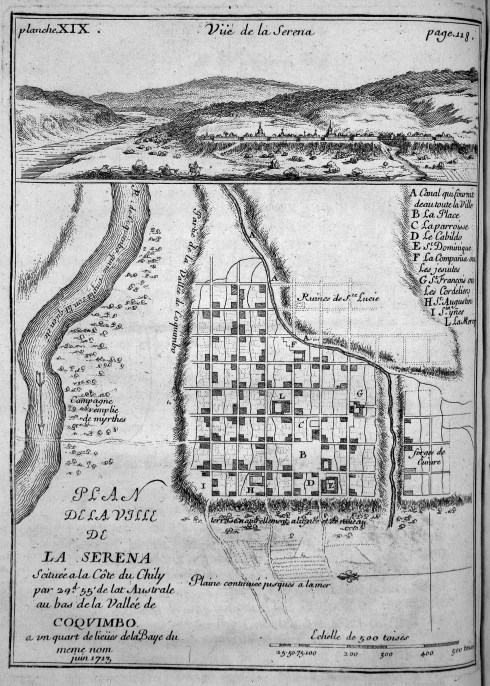
La Serena was first founded on the orders of Spanish Pedro de Valdiva in order to provide a sea link to maintain permanent contact between Santiago and Lima in the Viceroyalty de Peru. For this he would need a place for his troops to rest and eat. The village was first founded by captain Juan Bohon with the name “Villanueva de La Serena”. Although the exact date is disputed, probable dates include 15 November or 30 December 1543 and 4 September 1544. Many historians simply say that it was founded in 1544. Five years later, from the night of 11 January 1549 until the following day, an uprising of local Indians totally destroyed and burned the village, killing nearly every Spaniard. It was later that same year, Pedro de Valdivia gave orders to Captain Francisco de Aguirrer to found a new city under the name of San Bartolome de La Serena, now Patron Saint of the city……in the same place where today the Plaza de Armas stands.
During the 17th century, the city suffered continuous attacks from pirates, including Sir Francis Drake, who opened the Pacific route to pirates in 1578.

Suberbs
We passed by the university and suberbs…YES SUBERBS…and they look just like the ones back in Edmonton. Row on row of cloned houses…
We were heading to a place called Las Rojas in the Elqui Valley. The Tour Guide said this was where the Rojas name originated…true or not who knows! It was my grandmother’s name …Juana Rojas MacMillan.

Entering Las Rojas
The Elqui Valley, formerly known as Valle de Coquimbo , is a watershed located in the Coquimbo Region. There are numerous reservoirs located here and the valley benefits from these water resources, as well as the long periods of sun, both of which are excellent for production of fruits, vegetables and especialy the cultivation of grapes. Having one of the clearest skies in the southern hemisphere, several international organizations have installed astronomical observatories on the peaks of the Pachón and Tololo hills. This area is said to have an energy pole and has been associated with various arts.
Gabriela Mistral, Chilean Poet and Nobel Prize Winner for Literature in 1947, was born at Vicuna, here in the valley. Mistral’s meteoric rise in Chile’s national school system plays out against the complex politics of Chile in the first two decades of the 20th century. In her adolescence, the need for teachers was so great, and the number of trained teachers was so small, especially in the rural areas, that anyone who was willing could find work as a teacher. Access to good schools was difficult, however, and the young woman lacked the political and social connections necessary to attend the Normal School. She was turned down, without explanation, in 1907. She later identified the obstacle to her entry as the school’s chaplain, Father Ignacio Munizaga, who was aware of her publications in the local newspapers, her advocacy of liberalizing education and giving greater aceess to all schools for all social classes.
Although her formal education had ended by 1900, she was able to get work as a teacher thanks to her older sister, Emelina, who had likewise begun as a teacher’s aide and was responsible for much of the poet’s early education. The poet was able to rise from one post to another because of her publications in local and national newspapers and magazines. Her willingness to move was also a factor. Between the years 1906 and 1912 she had taught, successively, in three schools near La Serena and in Antofagasta in the desert north, in 1912.
Mistral may be most widely quoted in English for Su Nombre es Hoy (His Name is Today):
- “We are guilty of many errors and many faults, but our worst crime is abandoning the children, neglecting the fountain of life. Many of the things we need can wait. The child cannot. Right now is the time his bones are being formed, his blood is being made, and his senses are being developed. To him we cannot answer ‘Tomorrow,’ his name is today.”

The Gabriela Mistral – 41 CH International Route links this Region of Coquimbo with the Province of San Juan in Argentina, and seeks to be a complement to the future tunnel in the Agua Negra pass, which will also link both countries. Since July 2014, they have been working on the design for the expansion and replacement of this road. In the first stage they will begin construction between the urban boundary of La Serena and the locality of Las Rojas. It is a 15.8 kilometer stretch.

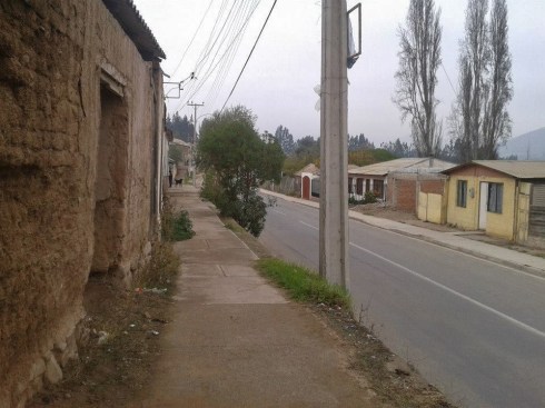
The road to Las Rojas
Small village

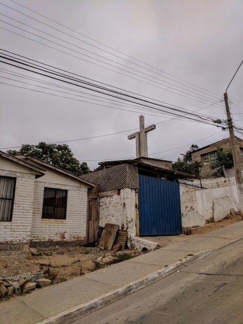
![]() We stopped at the church for a photo op.
We stopped at the church for a photo op.

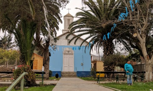
They really like Blue in the village

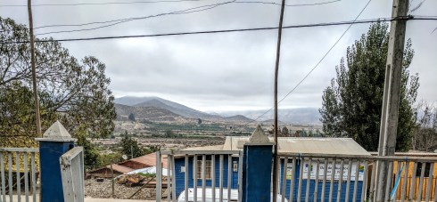
Looking back towards the highway we came in on and towards the hills
Then we headed back into La Serena to the local market.
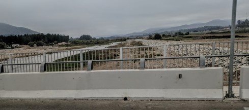
Not much water in the river bad at this time of year.

Colorful cafe
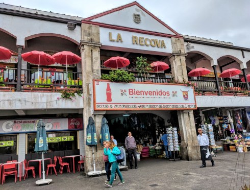
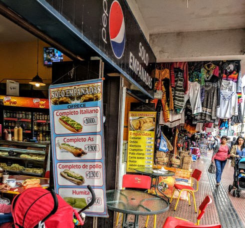
Local Market in La Serena

Chickens roasting

Wall Hangings


Flowers

Bookstall
A quick bite to eat and were were once again on the road to Coquimbo. It has been 98 years since my Mom left the place of her birth.
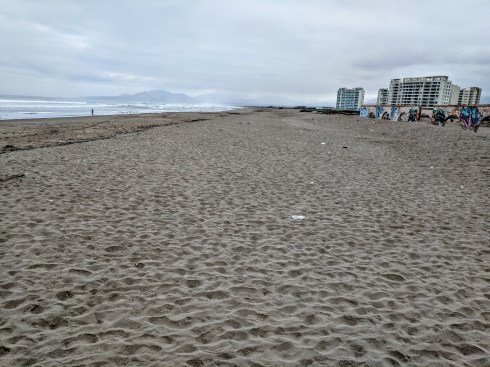
During the tourist season, this beach at La Serena would have been packed….this is how I like it….empty
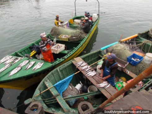
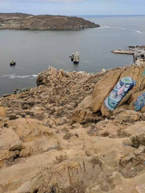
Along the coast road we came to the fishing port.
Beach Hotels of la Serena in the Background
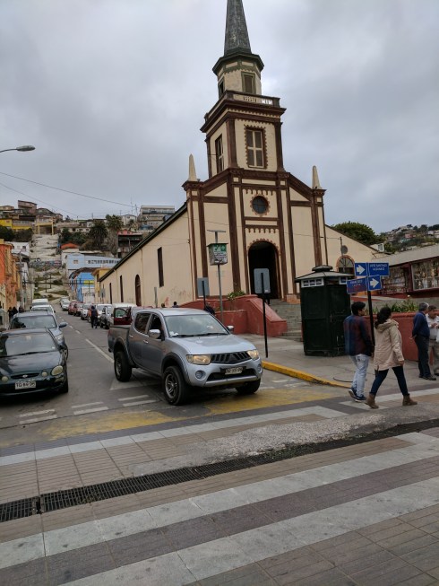
I never expected to visit Coquimbo because it was so far away and South America had never been on my “Must See List”. I had googled pictures of the Port and the Plaza de Armas. In recent years it is the port where many of the Big Cruise Ships make a stop. We drove along the shoreline of the Habour which connects the two cities..La Serena and Coquimbo. Finally we were in Coquimbo proper. My eyes were looking for that distinctive church on the Plaza de Armas that I had seen in so many pictures and the suddenly..there it was.

Plaza de Armas Coquimbo

Plaza de Armas Now with Same Hotel?

Plaza de Armas Then (1929) with Hotel
We continued along the one way to come back directly in front of the church where we would park.
Many more houses than on the hill back when…
The Church of San Pedro is a parish located in the Chilean city of Coquimbo. It is the main Catholic religious center in the community, and is located in front of the Plaza de Armas de Coquimbo. The church was built in the middle of the nineteenth century on the land donated by Buenaventura Argandoña. The 19 of November of 1857 it was designated a parish by the bishop of La Serena.

And here I am in Coquimbo…
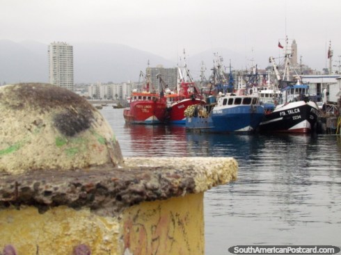
Coquimbo is a town ll kms from La Serena. Its population is 188 thousand inhabitants and it is the main port of the region. Unlike the striking churches of La Serena, in Coquimbo, it is the fishing industry, distilleries, tanneries and construction that stand out. In recent years, tourism has also had an increase.
The natural harbor in Coquimbo was taken over by Pedro de Valdiva in 1550. The gold and copper industry in the region led to the city’s importance as a port around 1840 and many Europeans especially from England settled in Coquimbo. In 1879 it was recognized as a town.
Mining and agricultural activities account for the location of various places in and around the region. Originally this organization was structured according to the location of Indian villages of the Diaguitas. A high percentage (70-75%) of inhabitants are of Mestizo(Euro-Amerindian) background, higher than any other region in Chile. Other indigenous peoples include the Aymara, Atacamenoc, Mapuche, and Quechua who were immigrants themselves from Peru and Boliva.

- San Pedro Church
We continued driving through the gritty port of Coquimbo. You could see the difference in the structures from La Serena.
- Driving through the Barrio de Ingles
The pictures are from Post Cards


Houses on the hill above the port
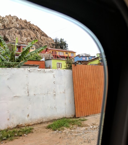
Colorful houses heading to the Fortress on the Penninsula
Fort Lambert (also known as Fort Coquimbo) is a nineteenth century fortification situated on the “Castillo del Carmen” hill at the southern end of Coquimbo Bay. This part of the city is known as “Punta Pelícanos” (“Pelican Promontory”) because just off the coast there is a small island inhabited by pelicans. Fort Lambert no longer has an operational role militarily, but it is a popular tourist destination because of the views it provides across the Bay of Coquimbo. The fortress was constructed here by a entrepreneur Carlos Lambert in order to protect the port of Coquimbo from possible attacks by Peruvian ships during the War of the Pacific. A 150-pound muzzle loading cannon from the British Armstrong munitions company was installed on 10 July 1879 by soldiers of the Municipal Artillery Brigade. It had been brought to this site by Joseph Lambert.

For more than a century the fort was maintained in its original state, with the canon positioned at its center. Due to structural deterioration, in 2003, the municipality launched a rescue plan which involved investing 68 Million Pesos. The structure was both restored and expanded, with the addition of three additional stone-built low lookout towers with lighting and benches. The restored Fort Lambert was officially inaugurated in 2005.

Looking down toward the small fort

Wonderful rock formations
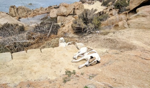
Wild dogs

Looking across the bay towards the beach hotels of Coquimbo
We spent some time here checking out the views and the wonderful rock piles as we had the entire site to ourselves. ….only a couple of old dogs lying around..NO OTHER PEOPLE.
You don’t appreciate the size of the cross till youn get there…
I had seen a number of pictures of this structure, but I had no idea what it was for nor did I realize the views from up there.
I copied an article from the internet. It explains the entire site…I will put it at the end of this Blog. Meanwhile here are some of my pictures.


Our next stop was to be at the grounds where the Pampilla de Coquimbo (local Festival) is held every year. I have pictures of my Mom at this very place some hundred years later.

Mom is one of three girls with their heads together near the bottom
The Pampilla de Coquimbo , or simply La Pampilla , is a festival that takes place between September 18-20 each year – although it usually extends two days before or two days after those dates – in the esplanade of the same name, located in the city of Coquimbo. During that time, even weeks before the activity starts, hundreds of families settle into tents and vehicles in the hills.

Likely my grandfather and grandmother are in the photo..???
Pampilla Grounds

Harbour at Guayacan

Guayacan Church

Agnes Irvine MacMillan Perkins age 10
Our final stop was the Cementerio de Ingles at Guayacan where my Grandfather was buried in 1917. The family left for England in 1919, leaving behind their beloved Husband and Father. They were going to Kent England to join their son/brother who had gone over in 1917 to fight in WW1.
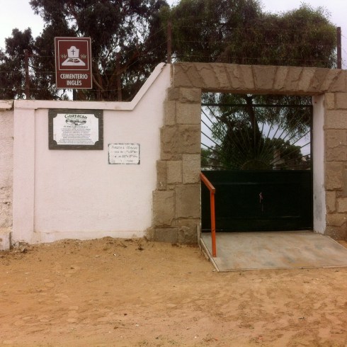


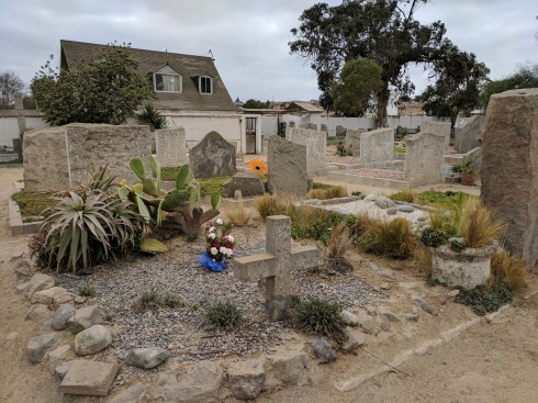


We were not able to find his exact gravesite, but it was comforting to know that he was being well cared for in this beautiful location. He had been alone for so long….but I am sure he knew that a family member had come to say “Hello Grandfather and Goodbye Grandfather…..you are not forgotten!”

Thomas MacMillan c.1850 to 1917
And after a day like none other……… the most fitting thing to do would be to celebrate at the Terraza Restaurant with local Food and Drink…so I did!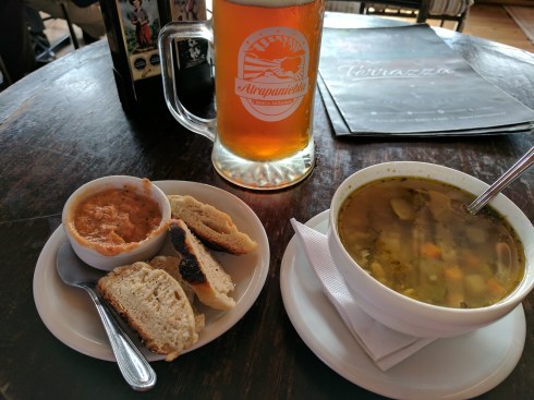
Third Millennium and its life-size ‘Via Crucis’ SPECIAL
IN WORLD
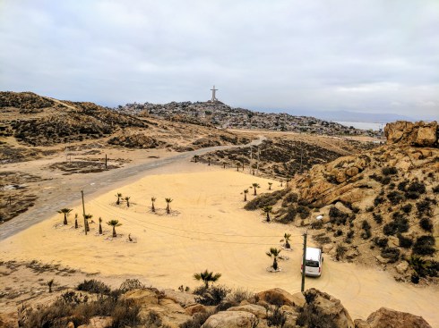
Coquimbo – The Cross of the Third Millennium of Coquimbo, Chile, is the largest religious monument in South America. It was built for the Jubilee of the Year 2000 of the Catholic Church. It has a high-tech bell tower and a Way of Sorrows with life-size sculptures.
In the 90s, the civic authorities of Coquimbo came up with the idea of building a monument to commemorate the Jubilee of Year 2000 of the Catholic Church, celebrating 2000 years since the birth of Christ, and the introduction of the Church into the third millennium. The project, appropriately called “The Cross of the Third Millennium,” gained great support from local church authorities and the Vatican.
The site chosen for the construction of the structure was the summit of Cerro El Vigía (Lookout Hill), located at 157 meters above sea level. The hill overlooking Coquimbo Bay has historically been home for the city’s poorest residents. With funding from the community, businesses and the support of local and national political and religious authorities, the construction of the structural work of the impressive cross was completed in a record period of 10 months, in May 2000.

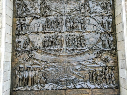
Life-size bronze sculptures of The Stations of the Cross at the Cross of the Third Millennium in the port of Coquimbo, Chile.

Life-size bronze sculptures of The Stations of the Cross at the Cross of the Third Millennium in the port of Coquimbo, Chile. Station X – Jesus’ clothes are taken away.

Life-size bronze sculptures of The Stations of the Cross at the Cross of the Third Millennium in the port of Coquimbo, Chile.

Life-size bronze sculptures of The Stations of the Cross at the Cross of the Third Millennium in the port of Coquimbo, Chile.
In 2004, efforts began to construct a large Via Crucis comprising the traditional 14 Stations of the Cross with scenes extending from “Jesus is Condemned to Death” to “Jesus is Laid in the Tomb”, plus a 15th station representing the “Resurrection of Jesus”. The complete set was made in bronze by Italian sculptors Giuseppe Alambrese and Pasquale Nava. It consists of 53 sculptures of human figures measuring from two to 2.2 meters in height plus eleven 3.5-meter-high crosses.
In 2006, the Coquimbo City Hall decided on the construction of a bell tower. Nine 1.5-meter-high bells were made by Rincker Bell Foundry in Sinn, Germany, and installed in May of 2013 in a 33-meter-tall tower next to the cross. The nine-bell system is computer-controlled and has 480 melodies in memory, including Chile’s national anthem.
The great cross is made up of three columns that emerge from an equilateral triangle representing the Holy Trinity. The structure is 93 meters tall and the arms measure 40 meters. The central column contains an elevator that brings visitors to the 40-meter-high arms where there are large windows allowing a 360-degree view around the cross.
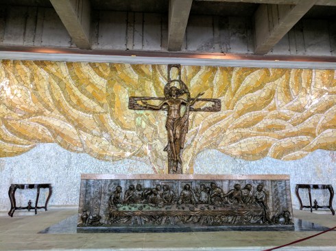
At the base of the cross there is a museum and a prayer chapel with an altar whose facade has a large embossed brass image of “The Last Supper”. On the second level there is a bronze statue, a replica of Michelangelo’s Pietà, the famous work of art depicting the body of Jesus on the lap of Mary after the Crucifixion. On this level there is also a set of 10 cylindrical columns symbolizing the Ten Commandments. The 15 Stations of the Cross were installed in the gardens surrounding the giant cross and on the terraces of the second level.

The site chosen for the construction of the structure was the summit of Cerro El Vigía (Lookout Hill), located at 157 meters above sea level. . On the left of the image is the bell tower with nine bells.

View of part of the city and the port of Coquimbo from the arms of the Cross of the Third Millennium.
The Cross of the Third Millennium is the tallest religious monument in South America and the sequence of Stations of the Cross is the largest in the world. The monumental complex is motive of great devotion and pride for the people of the city of Coquimbo and has become a major tourist attraction for local and foreign visitors.
